Weather
São Jorge-GO
Today - Qui (25/06)

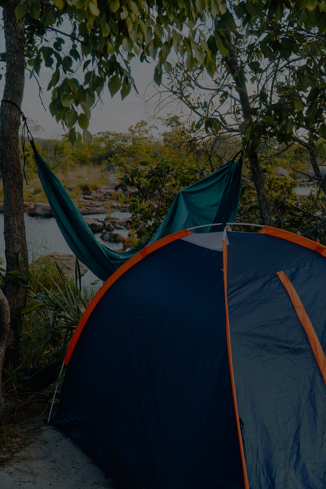
The Chapada dos Veadeiros National Park is in the northeast of the State of Goiás, between the municipalities of Alto Paraíso de Goiás, Cavalcante, Teresina de Goiás, Nova Roma, and São João d’Aliança.
Created in 1961, the site protects an area of approximately 240,611 hectares and is part of the Cerrado biome. There are unique plant species, springs and watercourses, prehistoric rocks, and a landscape of extraordinary beauty formed by details that have changed over time.
Besides all its natural charm, the Chapada dos Veadeiros National Park is known for preserving areas full of history, such as the old mining sites important to the region’s culture.
For these reasons, UNESCO included the site in the Natural World Heritage list in 2001.
Constant activities are carried out in its areas, including walks and refreshing waterfall baths – an excellent opportunity for visitors who want to relax and be inspired amid a rare landscape used as a route by miners many years ago.
In 2019, the Federal Government granted Parquetur a concession to manage the public use of the Chapada dos Veadeiros National Park and provide visitor support services. Since then, we have committed to improving infrastructure reforms, revitalizing green areas, and conserving the Cerrado biome.
The Park can be visited all year round. Typically, the dry season runs from May to October, and the rainy season extends from November to April.
Before planning your trip, please check the attractions you are interested in, their availability, and the best times to visit.
The Yellow Trail runs through a steep and stony terrain. Along the way, visitors will pass
through areas of ancient, quartz crystal mining and Cerrado biome plant physiognomies.
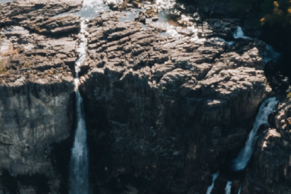
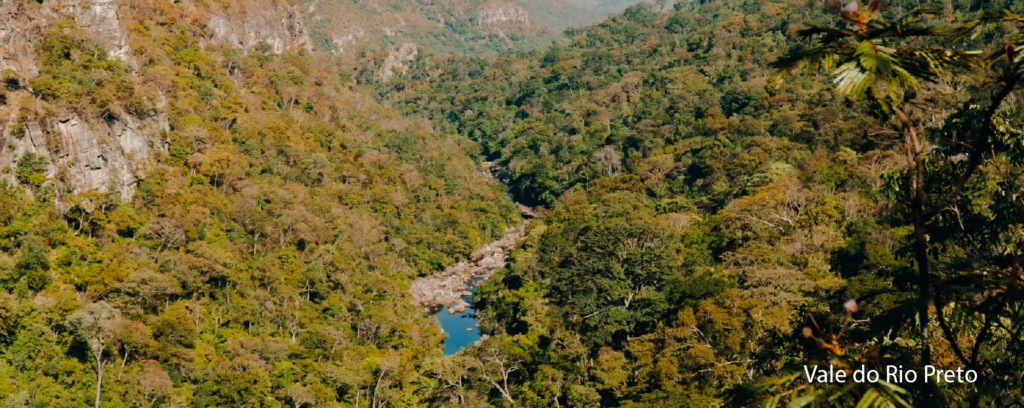
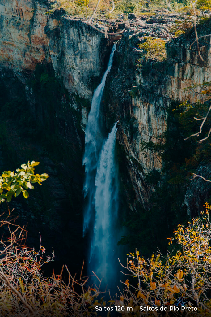
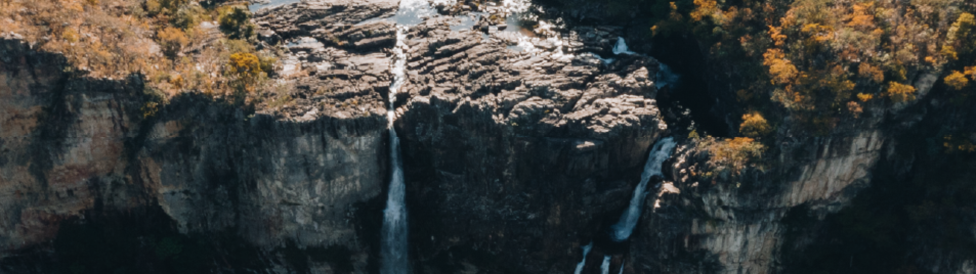
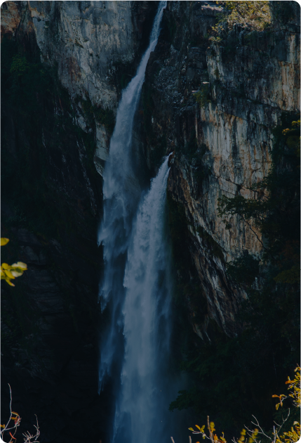
This path gives direct access to the Salto do Rio Preto viewpoint, which has a 120-meter free
fall, and the 80-meter Garimpão (Big Mine) waterfall, perfect for a fresh splash in the river.
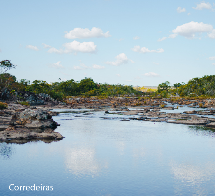
The Carrossel, on the other hand, is made up of a complex of waterfalls and canyons. In
contrast, the Corredeiras (Portuguese for rapids) are made up of small waterfalls and natural
pools, excellent for a refreshing swim.
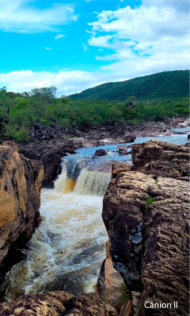
The Red Trail runs along stony paths with a slight inclination. While at it, visitors will pass by
watercourses and various Cerrado biome plant physiognomies. It also provides access to the
famous Canyon II, which has a large swimming well in the Rio Preto.
Another attractive access is the Cachoeira das Cariocas, which also offers waterfalls and pools.
The advantage is that both attractions can be visited on the same day, with an average of half
an hour’s walk between each point.
Check the trail map here.
The trail has a flat, well-marked route, providing access to Córrego Preguiça (Lazy Spring) – a
temporary river where, in the rainy season, visitors can bathe in small pools and waterfalls.
Since it offers a mild difficulty level, the trail suits people with walking problems, including
seniors, children, and pregnant women.
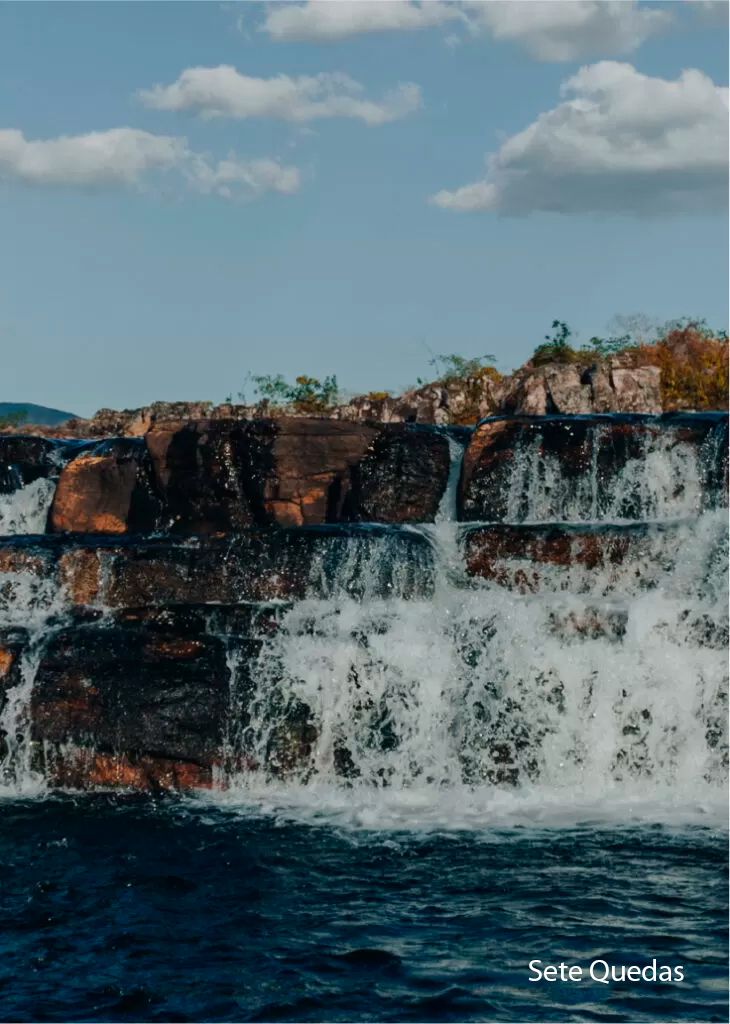
On the Sete Quedas Trail, the first few kilometers overlap and join the Canyons Trail and the
Cachoeiras das Cariocas Trail. After about 4 km, visitors will reach a fork in the trail. From that
point, it’s a 1.5 km walk to Canyon I.
After walking for 3 kilometers, you will reach the Boa Sorte camp, located near the first
crossing of Rio Preto at Poço da Capivara — an excellent spot for swimming. From there, you
need to walk another 9 km through clean fields, rupestrian and cerrado areas until you reach
the Sete Quedas campsite close to the waterfalls.
Following the trail, you’ll have to cross the Rio Preto again and walk another 6 km to the trail’s
end. The terrain is rocky and steep. Eventually, you will emerge onto the GO-239 highway.
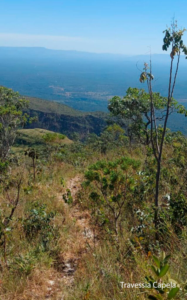
From the Visitor Center, follow the same route as the Sete Quedas Crossing for the first 15 km
in the direction of Capela. The Sete Quedas Crossing is well-established and well-signposted.
Follow the trail marked with red arrows to the Canyons and Cariocas until you reach the fork
that leads to Sete Quedas and Canyon I. Follow the path marked with orange arrows. The fork
towards Capela is signposted with wooden signs. In the new section, follow the directions of
the rustic signposts (footprints) on the Caminho dos Veadeiros (Veadeiros Way).
Follow the yellow footprints on a black background in the south-north direction (São Jorge to
Capela). In the north-south direction (Capela to São Jorge), follow the black footprints on a
yellow background.
For meals and an overnight stay at Capela, visit:
http://www.redetrilhas.org.br/w3/index.php/as-trilhas/trilha-regional/caminhos-dos-
veadeiros
Clique aqui e acesse a orientação completa.
The sky at Chapada dos Veadeiros is spectacular! In places further away from the cities, such
as deep inside the National Park, you can see all the constellations, planets, and moon phases
and have an incredible experience.
Moreover, there are thousands of hectares of protected areas where the rich fauna of the
Cerrado biome lives, which can be observed at more favorable times, such as dawn, especially
the bird species. Also, you can enjoy nighttime activities on the Chapada dos Veadeiros
National Park trails in the São Jorge Visitor Area.
Visits during this period will take place in small groups of no more than six visitors,
accompanied by a guide with PNCV accreditation.
All visitors and the guide must have their flashlights. Flashlights from cell phones will not be
accepted.
The ticket office and Visitor Center will be closed at these times, so tickets must be purchased
in advance.
Chapada dos Veadeiros National Park is open daily. Access on foot is from 8 am to 12 pm, and access by internal transport from 9 am to 3 pm.
Specific entries:
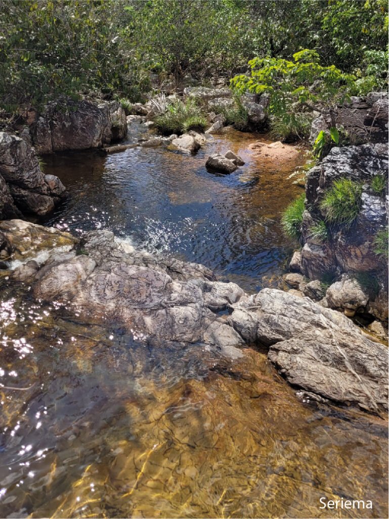
Seriema = until 4 pm on foot (available seasonally)
Corredeiras = until 4 pm by hiring internal transport.
Night Visit = from 8 pm to 6 am, except on Mondays and Tuesdays. It’s a requirement to hire an ICM Bio-accredited guide)
Departure from the Park must occur by 6 pm for all visitors (except overnight visitors).
The park entry is in the district of São Jorge, 36 km from the municipality of Alto Paraíso de
Goiás. To get there from Brasília-DF, take the BR-020 highway towards Formosa-GO.
At the interchange, take the BR-010 towards Alto Paraíso. After passing the border between
the Federal District and Goiás, BR-010 changes its name to GO-118.
Our commitment to the Itatiaia National Park.
In 2019, Parquetur won the bid for the concession of the Chapada dos Veadeiros National Park and began managing public use of the park and providing visitor support services.
The contract provides a 20-year concession and a commitment to preserve the park’s environmental heritage and improve its infrastructure.